


Quick Answer:
Chinchero’s premier downhill route is fast, steep, and thrilling, but safety must come first. Conquering this high-speed descent requires full protective gear, perfectly tuned brakes, and smart speed management to handle its sharp drops and loose rocky sections safely.
If you are looking for an authentic mountain experience in the Andes, The Best Downhill Route in Chinchero is one of the most complete descents you can ride in Cusco, with open views toward the Sacred Valley. In this guide, you will see what makes this route special, where it starts and ends, what skill level is best, and what to bring so you can ride safely. And if it is your first time in the area, you will also understand why going with a guide can make a real difference when it comes to choosing safer lines and avoiding common mistakes.
Want to ride one of the most technical trails in the Sacred Valley? Explore our Day Tours in Cusco designed for riders looking for real enduro in the Andes.
Why The Best Downhill Route in Chinchero stands out in Cusco
Chinchero sits at about 12,335 feet (3,760 meters) above sea level, on an Andean plateau that connects Cusco with the Sacred Valley. From there, many versions of the descent lose between 2,300 and 3,280 feet (700 and 1,000 meters) of vertical drop toward lower areas of the valley. That combination of high starting elevation and progressive descent gives you a long, fluid, and physically demanding ride, even if much of the route is downhill.
Unlike a bike park in the United States or Europe, here you will not find constant mechanized maintenance, artificial compaction, or permanently built jumps. Instead, you will ride on:
-
- Community dirt roads with hard packed surfaces
- Open trails across high Andean hillsides
- Sections with loose gravel and embedded rock
- Agricultural stretches and grazing areas
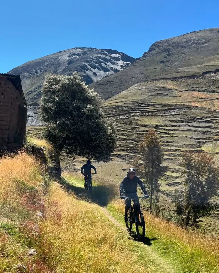
The landscape blends a rural atmosphere, Andean altitude, and a sense of wide open calm.

Beside the trail, thick green vegetation frames the mountain route.
Where the route starts and where it ends
Section 1: Chinchero (upper area) rural roads of Cuper
You begin in the upper access points of Chinchero, and the most common entry is through sectors such as Cuper, depending on the exact starting point. Here, the terrain is usually hard packed dirt with fine gravel. It is an ideal section to adjust to the altitude, test your brakes, and settle into a rhythm without riding at extreme speed.
Section 2: Upper area transition
As you continue, the terrain becomes more distinctly Andean: embedded rocks appear, along with loose gravel sections and narrower stretches. In some variations, you may pass through roads that connect to nearby sectors of the Sacred Valley, always staying outside restricted archaeological zones.
Section 3: Descent toward the Sacred Valley Urquillos / Huayllabamba
The final section usually heads toward Sacred Valley communities such as Urquillos, Racha, or Huayllabamba, where the terrain tends to open up again with wider rural roads. Here, you can ride more fluidly, but still with care: these are shared routes, and dust or gravel can still appear in corners.
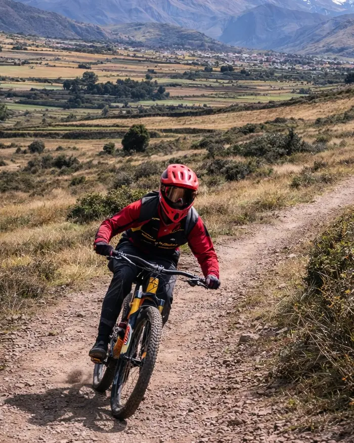
Downhill starts on rural roads in Cuper, with compact dirt and fine gravel to find your rhythm fast.
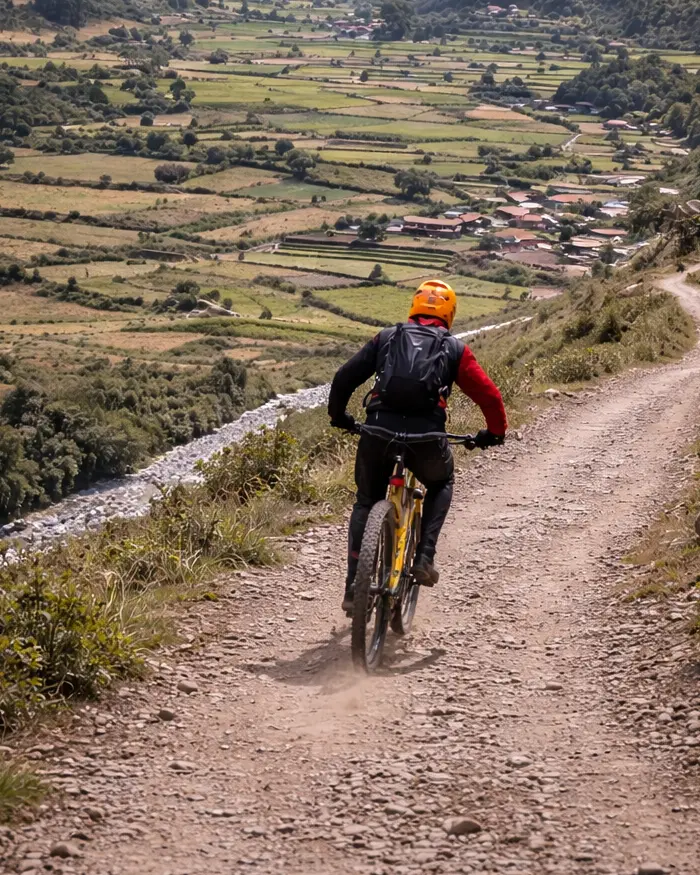
The terrain combines loose gravel and hard packed sections that let you ride fluidly, but still demand attention in corners.
What the terrain is like on The Best Downhill Route in Chinchero
In this area, the terrain is defined by the following:
High altitude hard packed dirt
This is the most common base throughout the route. In the dry season, it lets you carry good speed, but it still demands solid control in long corners.
Loose gravel in open sections
It usually appears in corners and changes in gradient. It reduces lateral grip and forces you to brake early.
Embedded stone and natural rock
This is typical of Andean roads. It creates constant vibration and requires a strong body position to stay in control.
Fine dust in the dry season
It forms because of intense solar radiation and lack of rain. It makes descents feel faster, but it can reduce traction in corners if you enter too aggressively.
Mud and wet rock in the rainy season
This lowers traction and lengthens braking distances. Also remember that these routes are used by local communities, so it is best to ride with extra attention and respect.
Did you know…?
In the dry season, dust can reduce visibility if you are riding in a group.
Real difficulty level
| Key factor | How it affects the difficulty | Impact level |
| Altitude | Less oxygen, faster fatigue, and a possible drop in concentration. | High |
| Vertical drop | A prolonged descent that demands continuous control and muscular endurance. | Medium to High |
| Natural terrain | Loose rock, gravel, and constant surface changes. | High |
| Absence of artificial berms | There are no built berms or bike park style maintenance. | Medium |
| Exposure in some sections | Open stretches with moderate side exposure. | Medium |
| Weather conditions | In the rainy season, mud and wet rock noticeably increase the difficulty. | Variable (can be High) |
| Mandatory jumps | There usually are no large mandatory jumps. | Low |
💡 Pro Tip — Altitude and concentration
At more than 12,139 feet (3,700 meters), the available oxygen drops by about 35 to 40% compared with sea level. That translates into greater muscular fatigue, slower reaction time, and more difficulty staying focused in technical sections. Even though you are descending, it feels like you are riding with extra weight. Plan for at least 2 nights in Cusco before riding this route.
Best season to ride in Chinchero
| Aspect | Dry season (May to September) | Rainy season (November to March) |
| General weather | Mostly clear days, low chance of rain, and cold nights. | Frequent rain, especially in the afternoon, with more stable mornings. |
| Average temperature | 41°F to 68°F (5°C to 20°C). Cold mornings and mild midday temperatures. | 44°F to 66°F (7°C to 19°C). Higher humidity overall. |
| Trail condition | Firm, compact base with fine dust on the surface. | Mud, wet rock, and ruts formed by runoff. |
| Traction level | Good on straight sections; it can drop in corners with loose dust. | Low and inconsistent, especially on wet rock. |
| Trail changes | Stable and predictable for weeks at a time. | January and February: the heaviest rainfall months in Cusco. |
⚠️ Note on the rainy season
Between November and March, mud and wet rock can significantly reduce traction. January and February are the rainiest months in Cusco. If you are planning to come during that time, check the trail conditions in advance, since they can change from one day to the next.
What to bring for this route
- Certified full face helmet.
- Durable knee pads.
- Gloves with good grip.
- Glasses for dust, wind, or splashes.
- Enough hydration: at least 1.5 to 2 liters.
- High SPF sunscreen.
- Layered clothing: thermal layer plus windbreaker.
- A full suspension bike in good condition.
- Checked brakes: pads and rotors in excellent condition.
- Multi tool and a basic spare: tube or tubeless kit.
- Light energy snacks.
- Travel insurance with adventure sports coverage.
Pro tip:
Bring gloves with good grip to reduce vibration and improve control.
The cultural and scenic setting
In Chinchero, you are not just coming to ride downhill. You are also moving through an Andean landscape with living history. The area is known for its Inca and colonial heritage. You will see agricultural terraces, communities that preserve textile traditions, and open views toward the Sacred Valley, all of which add a great deal of value to the route.
In the center of town, you will also find finely worked Inca stone walls topped by a seventeenth century colonial church. That layering of Inca foundations and colonial structure clearly reflects the history of Cusco after the arrival of the Spanish.
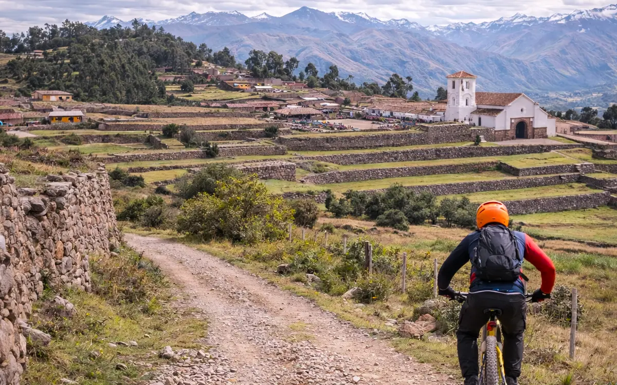
Stone walls line the road, reflecting the cultural heritage present in every area near the town.
Why ride this route with a guide
A local guide knows the current trail conditions, identifies safer lines, and avoids damaged sections or areas with unnecessary risk.
Likewise, a guide knows which areas are rideable, which should be avoided, and how to move respectfully through local communities. This not only improves the experience, but also prevents conflicts or improper access.
Keep in mind that a specialized downhill operator also gives you:
- A technical briefing beforehand about terrain, altitude, and real risks.
- Proper transportation, with shuttle service coordinated to the high starting points.
- Bikes in solid mechanical condition, adjusted for downhill riding.
- Appropriate protective gear and clear recommendations based on the season.
- Safety protocols and first aid support in case of a fall.
The Best Downhill Route in Chinchero is a real mountain experience at altitude, with changing terrain and a cultural setting that gives it unique value within Cusco. If you choose the right season, bring the right gear, and understand the level it demands, you will enjoy a long, fluid, and challenging route.
Thousands of travelers have trusted Peru Biking Tours to enjoy unforgettable experiences in the Andes.
Your safety comes first
Routes adapted to your level, expert local guides, and full support at every stage.
No need to worry about a thing
We handle all the logistics so you can focus on enjoying the scenery.
Authentic routes in Cusco
Experience the Sacred Valley in a real way, at your own pace, with access to the best trails.
High quality gear
High end enduro bikes, helmets, and protective equipment for all levels.
Plan your MTB experience in Cusco
MTB Day Tours in Cusco
If you want to ride routes like Lamay Sapacto with the right logistics, local support, and the right trail selection, check out our MTB Day Tours in Cusco.
Multi-Day MTB Tours
For more complete experiences that connect multiple valleys and high mountain routes, discover our Multi-Day MTB Tours.


