


Quick Answer
On the Abra Lares MTB Route, expect three sections: a high-altitude scenic opener, a technical middle with rock gardens and stone steps (line choice and control), and a switchback/canyon finish (smooth braking). Bring an enduro/DH bike (160 mm+), a full-face helmet and pads, plus offline GPS and enough water due to the altitude.
Unlike commercial bike parks where everything is designed for easy speed, Abra Lares MTB Trail teaches you the true essence of mountain biking: reading natural terrain, respecting the ancestral mountain, and adapting to conditions that change with every blind corner. Each rock garden forces you to choose your line with Inca wisdom, each original stone staircase reminds you that you’re riding on paths that connected empires, and each Andean switchback challenges you to perfect your technique in South America’s most authentic natural laboratory.
Want to tackle one of the most technical trails in the Sacred Valley? Discover our day tours in Cusco designed for riders seeking real enduro in the Andes.
This isn’t just another trail: it’s your gateway to true Andean enduro, where every descent teaches you that mountain biking was born to connect with the mountain, not to dominate it.

What is the Abra Lares MTB Trail?
The Abra Lares MTB Trail is a hidden gem of authentic mountain biking in Cusco. With 7.22 km of natural descent, it combines progressive technical challenge, millennial history, and a unique connection with the Andean mountain range.
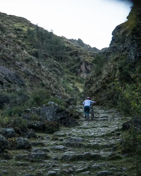
What distinguishes Abra Lares is its authenticity. There are no berms or artificial jumps; every turn and stone staircase are part of the original Inca road system. It’s mountain biking in its purest form, sculpted by centuries of natural erosion.
The trail follows ancient Inca paths that connected communities and served as ceremonial routes to the apus (sacred mountains). Riding here means participating in an ancestral tradition, where reading the terrain and respecting the mountain were essential for survival.
Where is it Located and How to Get There?
Abra Lares is located in the Andean mountain range, in the district of Lares, province of Calca, where three unique ecosystems combine: the high puna, inter-Andean valleys, and sedimentary rock formations. This strategic location creates the perfect terrain for natural enduro, offering a dramatic change of landscapes and technical challenges every kilometer.
The starting point is at GPS coordinates -13.3167°, -72.1833°, at 4,482 m altitude. From this pass, used as an Inca ceremonial point, the trail follows ancient horseback paths, respecting the original topography of the terrain.
Access from Cusco (110 minutes total)
- First stage – Paved road (70 minutes): Starting from Cusco’s historic center, the route follows the road towards Pisac and continues through the Sacred Valley corridor to Calca. This 45-kilometer section runs completely on good-condition asphalt, crossing the historic towns of Pisac and Lamay. The journey allows gradual acclimatization while enjoying panoramic views of the Sacred Valley that anticipate the grandeur of the route.
- Second stage – Dirt road (40 minutes): From Calca, the ascent towards the Lares pass follows a mountain dirt road that winds through Andean slopes with steep gradients. This section necessarily requires a vehicle with adequate traction and experience in dirt road driving. During rainy season, a 4×4 vehicle is essential due to terrain conditions.
Important: Access requires special transit permits through peasant community territory. It’s mandatory to have mountain GPS with offline maps preloaded, as the total absence of mobile signal makes autonomous navigation a critical safety issue. Prior coordination with local communities is recommended to avoid territorial conflicts.

What Makes the Abra Lares MTB Trail Unique?
The Abra Lares MTB Trail is distinguished by its combination of authentic Inca trails, where carved tight turns take advantage of natural topography to create the perfect flow without modern intervention. Additionally, millennial natural bridges formed by eroded rocks offer unique technical passages over ravines, impossible to replicate in any bike park. The geological rock gardens, formed by Andean sedimentary processes, challenge line-reading technique in its purest form. Finally, the ceremonial viewpoints, ancient ritual points to the apus (sacred mountains), today provide some of the most spectacular views of the Sacred Valley.
This route, with its rich archaeological tradition, exceptional geological formations, and progressive descent technique, offers an experience that transcends traditional mountain biking, becoming a true initiatory journey through the essence of Andean enduro.
Detailed Route Description
Key Route Points
| KM | Point | Description |
|---|---|---|
| 0.0 | Ceremonial Viewpoint | 360° panoramic view towards sacred apus and Sacred Valley |
| 3.6 | Imperial View | Direct panorama towards Ollantaytambo and Inca corridor |
| 11.3 | Regrouping zone | Flat section ideal for hydration and technical rest |
| 16.8 | Fast technical singletrack | Natural curves and stone steps at maximum speed |
| 7.2 | Opening canyon | Climactic point with spectacular valley view |
Recommended Equipment
Specific Bicycle
• Suspension: Full suspension with minimum 160mm front configured for enduro/downhill, essential for absorbing impacts from Inca staircases and natural rock gardens
• Brakes: 4-piston hydraulic system front and rear with 180mm/160mm discs, metallic pads mandatory for prolonged descents at extreme altitude
• Tires: 2.3-2.5 inch tires with soft compound specific for traction on Andean rock, aggressive pattern for mixed wet-dry terrain
• Drivetrain: Single chainring with wide cassette (11-50T) to manage technical climbs with reduced oxygen due to extreme altitude
Protection Equipment
• Full-face helmet with complete facial protection and ventilation optimized for extreme altitude conditions
• Goggles with 100% UV protection and anti-fogging treatment specific for Andean temperature changes
• Enduro-type knee pads with rigid protection and free articulation for pedaling on technical climbs
• Elbow pads with extended coverage for protection in rock gardens and Inca stone staircases
• Full-finger gloves with reinforced palm for prolonged grip on technical high-altitude terrain
Technical tip
Tire pressure should be reduced 15-20% compared to sea-level configurations to compensate for lower atmospheric density and optimize contact surface on Andean rocky terrain.
Safety and Precautions
Ride in a minimum group of three for safety (one stays with an injured rider, one goes for help, and one remains as backup), carry a mountain GPS with the full route preloaded plus offline maps due to zero cell coverage, bring a complete tool kit (quick link, two spare tubes, hand pump, and the right tire levers), carry at least 1.5 liters of water per rider, and have basic mechanical repair skills and first-aid knowledge for remote mountain terrain.
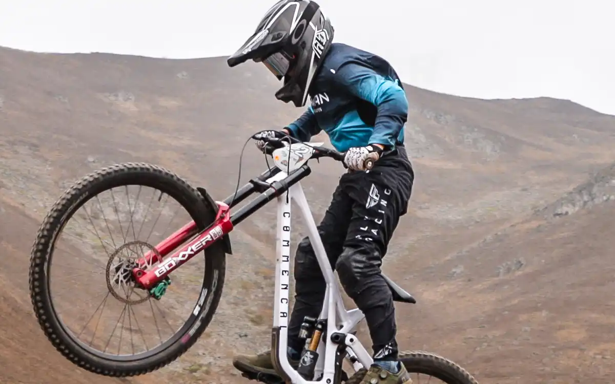
Wide-open Andes, dusty lines ride where the mountains feel endless.
What’s the Best Time to Do the Abra Lares MTB Route?
Dry Season (May-September):
- Firm terrain with excellent traction, optimal visibility for reading technical lines in rock gardens
- Extreme thermal variation: 15°C daytime, -5°C morning, thermal layering system mandatory
- Higher concentration of experienced riders, opportunity for technical exchange and collaborative learning
Wet Season (October-April):
- Slippery surface increases technical difficulty by 30%, especially on Inca staircases and natural wallrides
- Rapid formation of orographic fog can reduce visibility to less than 50 meters in minutes
- Intense green landscapes and lower attendance create a wilder and more contemplative experience, ideal for spiritual connection with the mountain
Comparison with Other Cusco Routes
Abra Lares vs Maras Moray
• Abra Lares: Pure natural enduro with integrated archaeological elements, extreme altitude, zero commercial infrastructure, initiatory experience
• Maras Moray: Accessible tourist trail, moderate altitude, developed commercial infrastructure, lower technical and spiritual challenge
Abra Lares vs Ollantaytambo Pumamarca
• Abra Lares: Concentrated descent with natural rock gardens, requires specialized transport, contemplative and technical experience
• Ollantaytambo Pumamarca: Integral uphill-downhill route, independent access possible, more complete physical profile but less cultural connection

Enduro in Lares, where the effort earns the reward and the mountains never feel small.
Do You Dare to Conquer the Most Authentic Andean Enduro?
Abra Lares isn’t for an easy ride, it’s for riders who want a real Andean challenge and a deeper connection to the mountain. Over 7.22 km, you’ll read raw terrain shaped by history, ride with respect for the land, and sharpen your technique without artificial features. If you’re ready for an authentic enduro experience in the Andes, Peru Biking Tours will take you there. Book now and come prepared.
Plan your MTB experience in Cusco
MTB Day Tours in Cusco
If you want to explore routes like Lamay Sapacto with the right logistics, local support, and suitable trail selection, check out our MTB Day Tours in Cusco.
Multi-Day MTB Tours
For more comprehensive experiences that connect several valleys and high mountain routes, discover our multi-day MTB Tours.


